Implemented by the European Commission as part of the Copernicus Programme
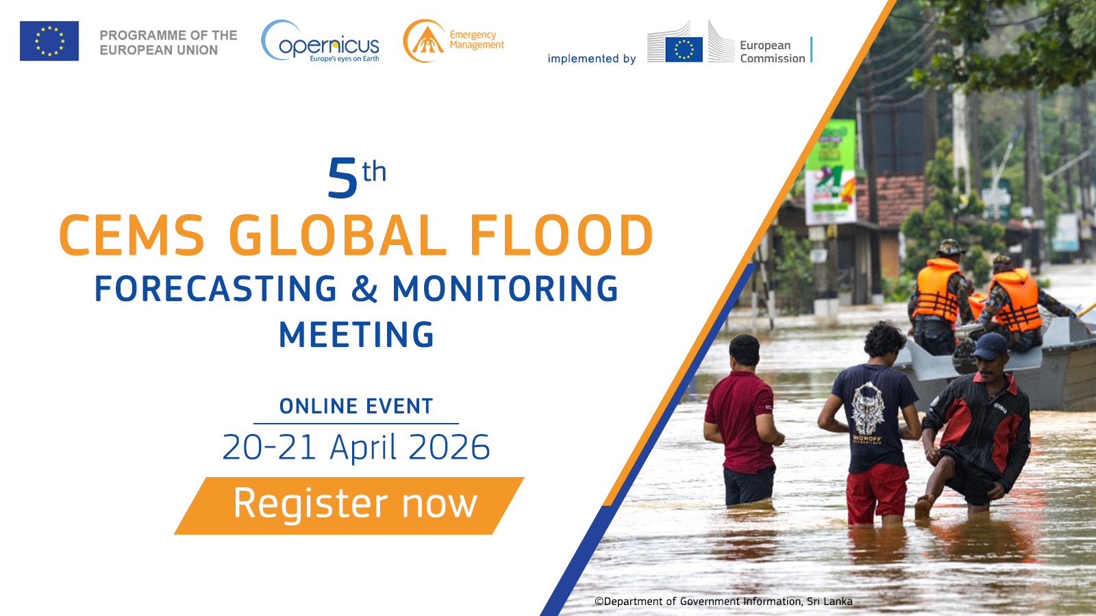
🗓 Dates: Monday 20 April, Tuesday 21 April 2026
🕒 Time: 12:00 to 15:30 (UTC) during both days of the event
📍 Location: Online. The meeting platform is Zoom.
📢 To register, please CLICK HERE
The meeting agenda will feature:
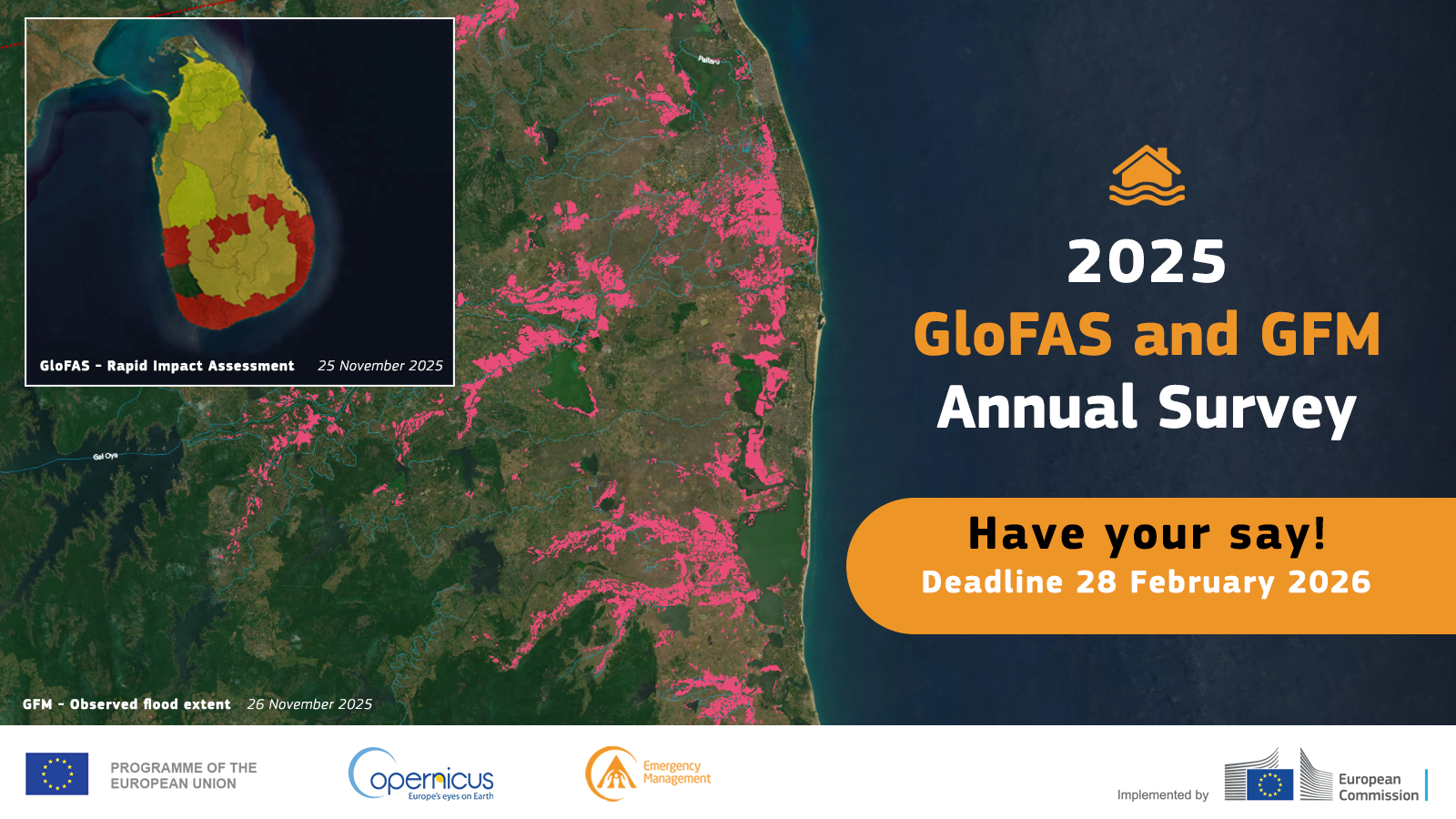
Your feedback matters! The survey consists of 4 quick questions which should take no more than 5 minutes to complete. It also contains three optional open-response questions in case you would like to share more about your experience or provide any suggestions.
What’s in it for you?
Your feedback regarding your experience with CEMS GloFAS and GFM allows us to improve our existing products and service, and to prioritise new features. By sharing your insights, you can shape the available products to be more useful and efficient for you!
You can join the survey by 28 February using the following link:
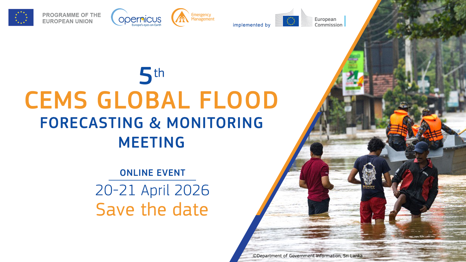
The Copernicus Emergency Management Service (CEMS) is pleased to announce the ‘5th Global Flood Forecasting and Monitoring Meeting’.
🗓 Dates: Monday 20 April, Tuesday 21 April 2026.
🕒 Time: 12:00 to 15:30 (UTC) during both days of the event.
📍 Location: Online. Registration details will follow soon.
The meeting agenda will feature:
We are reviewing the list of users that have access to the GloFAS Map Viewer. This review will support more efficient communications of system upgrades and issues, as well as events.
Have you accessed the GloFAS Map Viewer at least once in 2024 or 2025?
This message is also of interest to GFM users that access monitoring …

Please share your views and fill the CEMS GloFAS and GFM Annual Survey. This survey consists of 4 quick questions which should take no more than 5 minutes to complete. It also contains three optional open-response questions in case you would like to share more about your experience or provide any suggestions.
What’s in it for you?
Your feedback regarding your experience with CEMS GloFAS and GFM allows us to improve our existing products and service, and to prioritise new features. By sharing your insights, you can shape the available products to be more useful and efficient for you! …

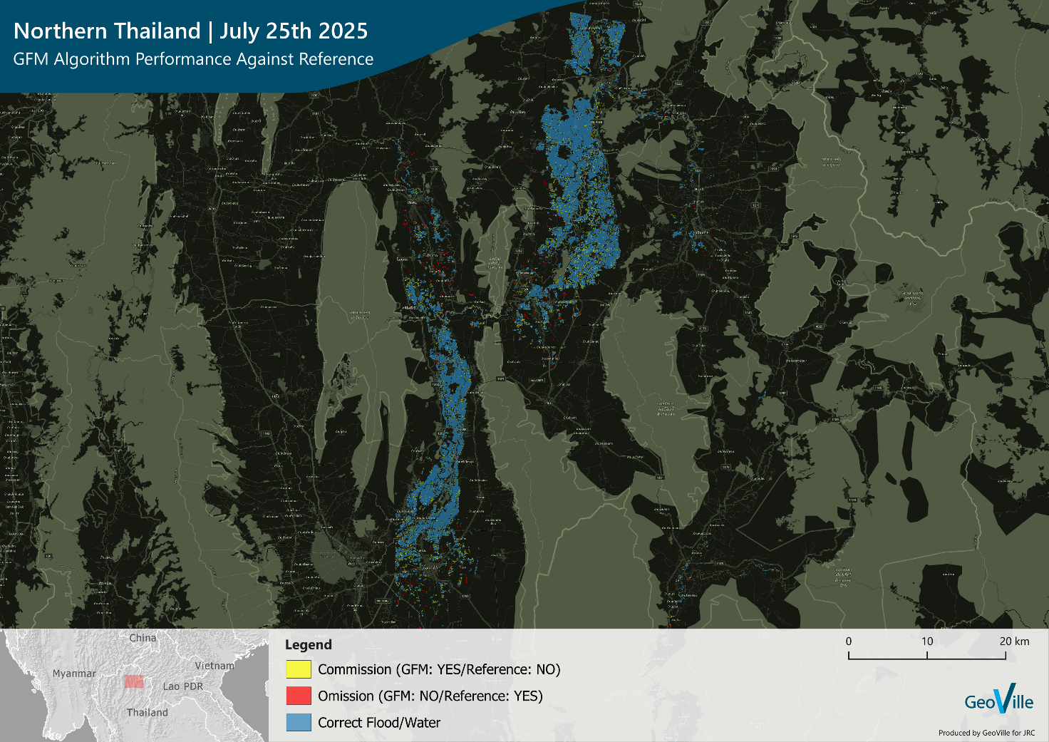
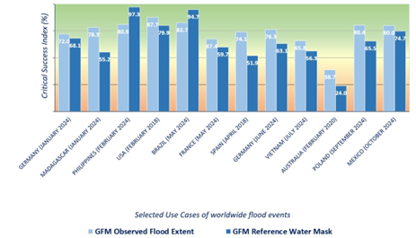
Since its start in 2021, the Global Flood Monitoring (GFM) product of the Copernicus Emergency Management Service has been continuously enhancing the quality of its outputs, developing new components for its satellite-derived data post-processing, refining its algorithms, and publishing the results of its regular (quarterly) product and service quality assessments.
The most recent GFM product and service quality assessment (for Q3 of 2025) includes the evaluation of the performance of the latest version of GFM (i.e. v.4) for the severe flooding that struck the Eastern India (August 2017), Central Romania (May 2025) and Northern Thailand (July 2025). For these Use Cases, GFM v.4 achieved …
The Global Flood Monitoring (GFM) product of CEMS complements the European Flood Awareness System (EFAS) and Global Flood Awareness System (GloFAS), by carrying out a continuous, systematic monitoring of all major global flood events in near real-time, based on the latest Sentinel-1 SAR images.
Every year the consortium responsible for the development and operational deployment of GFM, publishes the results of its regular (i.e. quarterly) GFM product and service quality assessment (QA), as well as updates on the latest quality-related technical improvements of the GFM product, as a JRC Technical …
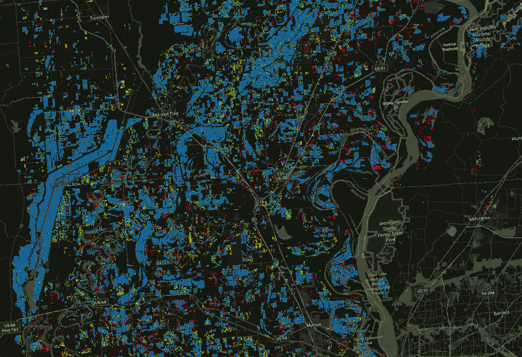
Since its start in 2021, the Global Flood Monitoring (GFM) product of the Copernicus Emergency Management Service has been continuously enhancing the quality of its outputs, developing new components for its satellite-derived data post-processing, refining its algorithms, and publishing the results of its regular (quarterly) product and service quality assessments.
The most recent GFM product and service quality assessment (for Q2 of 2025), includes a comparison of the performance of the previous and new versions of the GFM, for the severe flooding that struck the south-central US state of …
Due to unforeseen technical issues, GFM Data Download currently does not work. GFM staff is working to solve the issue as soon as possible. We apologize for any incovenience this issue might cause.

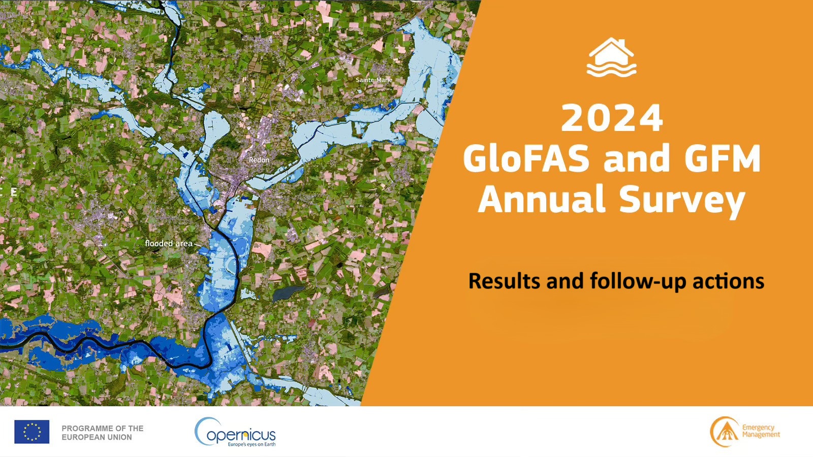
The Annual Survey for the reference year 2024 was conduced in March-April 2025: the results and the complete list of FOLLOW-UP actions are available from THIS PAGE.
Overall, the results indicate that there is high satisfaction with GloFAS and GFM service and products. However, there are opportunities for further improvement. More specifically, the survey responses allowed to identify 1 short-term (1 year) and 4 long-term (more than 1 year) follow-up actions. 2 actions are part of the continued improvements to the service.
The online page allows to monitor the progress of the actions …
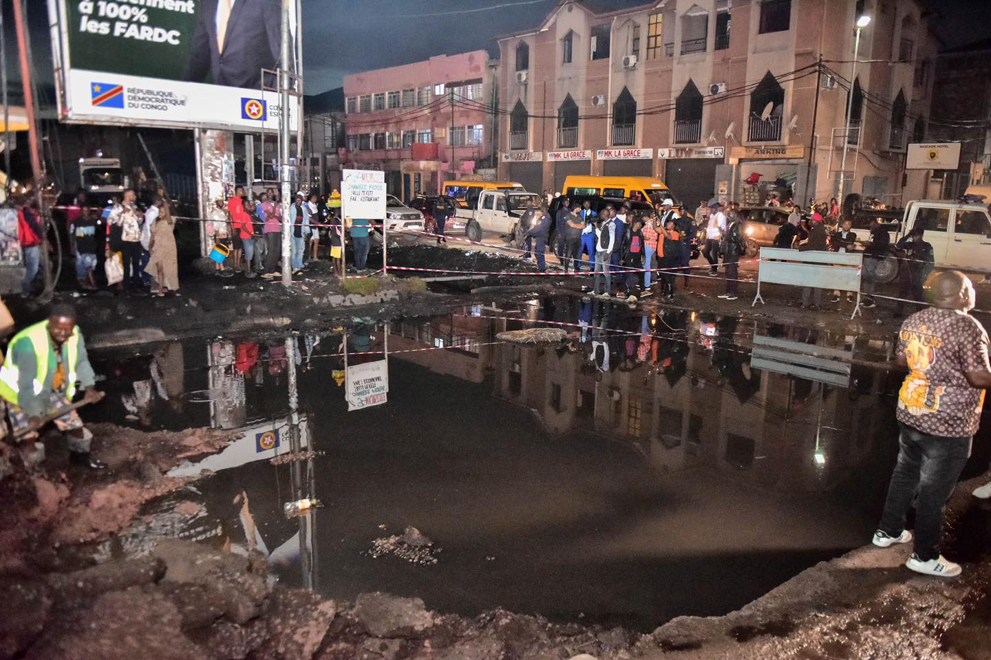
by Richard Davies, floodlist
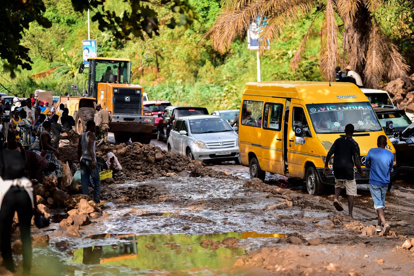
Kinshasa, the capital of the Democratic Republic of the Congo (DRC), experienced major flooding and landslides following heavy and sustained rainfall in early April 2025.
The flooding began during the night of 04 to 05 April. Heavy rain in the city and runoff from surrounding hills and river catchments in the neighbouring Congo Central Province quickly overwhelmed Kinshasa’s urban rivers, including the Ndjili and Lukaya, which run through densely populated areas of the city.
After the floods in Kinshasa, Democratic Republic of Congo, April …